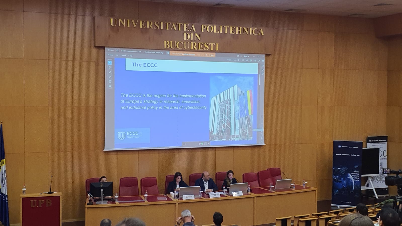
PROJECT TITLE: IncREO - Increasing Resilience through Earth Observation
Coordinator: Astrium GEO - Information Services (SpotImage SA [SISA])
Partners:
- geomer GmbH
- GeoVille GmbH
- UTITC [ITC]
- UNESCO
- NIMH
- Météo France [MF]
- (Infoterra GmbH [ITD]) Astrium GEO-Information Services
- DGSCGC
Period:
Project Director:
Descripton:
The project is co-financed by UEFISCDI through the program CAPACITIES, module III, projects supporting Romania's participation in international research projects, contract no. 233 EU/2013.
The project "Increasing Resilience through Earth Observation" addresses to research and development activities, aiming to achieve risk and hazard maps, including tools and products that help the reduction and preparedness for emergency situations.
The project envisages to improve the responsiveness of a system or of a natural disaster-prone community, by adapting to climate change, aiming to achieve and maintain a sustained level of operation.
The geoinformation content of risk and vulnerability maps corresponds to a multiple Earth observation data set and geoinformation layers including: optical data and/or radar topographic data, population density, transport network, water network, geological, land use and cover, historical data, socio-economic statistics etc.
Project objectives:
- analysis of legislation, strategies and effective prevention capacities in priority regions (EU Floods Directive, the Danube Strategy);
- analysis of priority areas in terms of climate and hydrologic change using Earth observation satellite data;
- application of methods based on Earth Observation satellite data to study the impact of human intervention on the use and land cover and increasing the incidence of natural disasters;
- defining and conducting case studies for each type of hazard (earthquakes, landslides, fires, floods);
- recommendations on prioritizing interventions in geographical areas prone to natural disasters.
- The objective of the work package which includes ROSA is to assess and map the areas of Romania exposed to risk and vulnerability as a result of earthquakes and landslides.
- Together with potential users of the project results (Ministry of Regional Development and Public Administration and the County Council of Buzau) ROSA will analyze the effectiveness of methods based on satellite data and the quality of the products obtained and assess the possibilities of integrating these methods into the operational procedures for assessing and mapping risks.
Activities:
Publications:
Project webpage: IncREO